


vSite AR app for iPhone and iPad
Developer: vGIS Inc.
First release : 18 Jan 2018
App size: 150.18 Mb
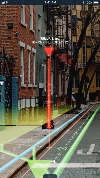
Using the vGIS system, field personnel can see an augmented view that includes holographic infrastructure objects, improving their environmental assessments and increasing their situational awareness. From delivering real-time, in-field holographic visualizations of underground pipes, valves, cables and other utility objects to visualizing ground penetrating radar scans, vGIS solutions are estimated to prevent 25% of excavation-related accidents resulting from human error, among other benefits.
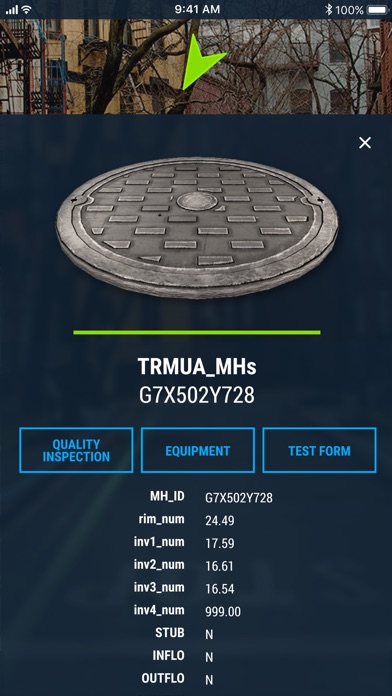
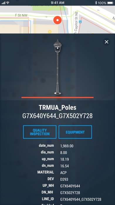
The system combines object holograms with object-specific data to provide a hands-free method for field technicians to understand the infrastructure they need to service while on site, quickly and safely.
Key features:
• Exceptional Accuracy
• Consistent Visualizations: 3D overlays stay “world-locked” by remaining in sync with the physical world
• Multi-Device Support
• No Additional Equipment: vGIS Utilities does not require any additional equipment
• Workflow Integration: vGIS Utilities integrates with your existing back-office systems
• Advanced Collaboration: Integrated holograms, video, and audio that connect the office with field teams
• Format Support: Esri Feature Services, Esri Map Services, Esri Scene Services, Esri Building Services, Bentley iTwin, WFS, WMS, WMTS, GeoJSON, KML
• GNSS Integration: Leica GG04 plus, EOS Arrow Series, SXBlue, TopCon and Trimble R series/Catalyst
• Multi-View Support: First-person on-site experience and birds-eye “zoom out” site overviews